


BackCountry Navigator XE
Topo
Description de BackCountry Navigator XE: Topo
Téléchargez et utilisez des cartes topographiques hors ligne pour explorer le plein air à l'aide de votre smartphone ! Utilisez le GPS de votre smartphone pour naviguer, marquer votre chemin et enregistrer des waypoints.
Regardez les avantages que BackCountry Navigator XE apporte à la table.
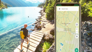
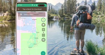
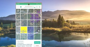
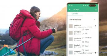
Téléchargement facile des cartes basé sur une grille
Vous pouvez essayer une approche plus simple pour télécharger et organiser des cartes hors ligne, en choisissant de grands carrés à la fois. Visualisez ce que vous avez et ce dont vous avez besoin.
Nous avons une variété de cartes spécifiques au monde et à un pays qui peuvent être téléchargées pour une utilisation hors ligne sur la base d'un abonnement annuel.
Abonnement Bronze pour utiliser la plupart des cartes.
Adhésion Silver pour utiliser également les cartes topographiques ombrées des pentes des États-Unis, ainsi que les cartes du US Forest Service.
Adhésion Gold pour utiliser également Accuterra Maps, avec de nouvelles cartes lisibles des États-Unis et du monde, ainsi que BackRoads MapBook Basemap au Canada.
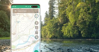
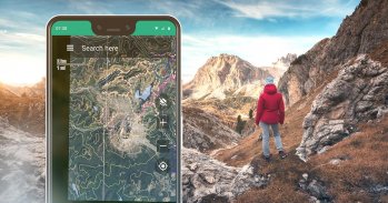
Cartes topographiques vectorielles pour le monde
La carte par défaut, BackCountry World map, est un ensemble de cartes topographiques vectorielles pour le monde. Les cartes en mosaïque vectorielle promettent des détails nets à plusieurs niveaux, avec la possibilité de télécharger de gros morceaux de la surface de la Terre en une opération rapide et compacte. La carte topographique BackCountry pour le monde peut être consultée dans cette application et sur
bcnavxe.com
, avec un processus simple pour les installer dans de grands blocs.
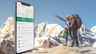
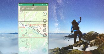
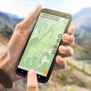
Navigation GPS
À l'aide du GPS dans un smartphone moderne, visualisez votre position sur une carte mobile hors ligne. Trouvez votre chemin vers les waypoints que vous marquez sur la carte ou créez en saisissant des coordonnées dans la barre de recherche.
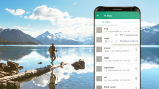
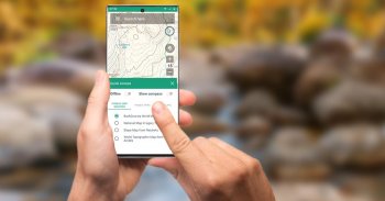
Planification dans le cloud
Le site Web
bcnavxe.com
est l'interface Web de BackCountry Navigator XE. Avec lui, vous pouvez tracer des points, des itinéraires et des limites pour les trajets, et les télécharger à la demande dans l'application mobile. Vous pouvez également pousser les voyages créés dans l'application mobile vers le cloud pour les réviser ou les partager.
Multi-plateforme
BackCountry Navigator XE fonctionne sur Android, dispose d'une application plus récente dans iOS et d'une application Web pour faciliter la planification sur
bcnavxe.com
.
L'application iOS est disponible via
Appstore
Nous sommes bien connus pour notre produit précédent
BackCountry Navigator PRO
qui est toujours soutenu et développé sur une voie parallèle.
https://play.google.com/store/apps/details?id=com.crittermap.backcountrynavigator.license
Pour voir pourquoi vous voudrez peut-être passer à XE à partir de PRO, consultez cette
comparaison
Vous pouvez également vous abonner à la liste XE pour être informé de l'état, des mises à jour et des offres.
BackCountry Navigator XE: Topo - Version 3.1.8
(19-11-2024)BackCountry Navigator XE: Topo - Information APK
Version APK: 3.1.8Package: com.crittermap.backcountrynavigator.xeAncienne Version de BackCountry Navigator XE: Topo
Autres versions


Applications de même catégorie


Vous pourriez également aimer...


